OsmAnd — Maps & GPS Offline
Navigation on hikes is no longer a problem. Download the map, put notes and go!

OsmAnd — Offline Maps & GPS Navigation App
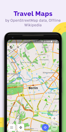
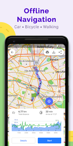
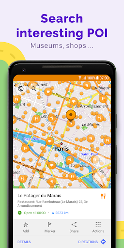
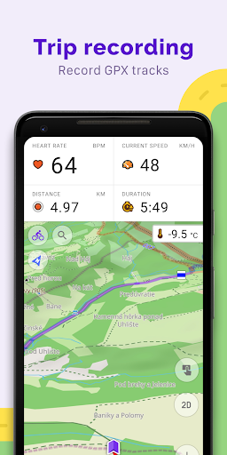
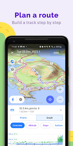
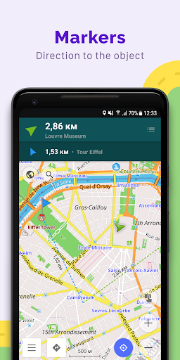
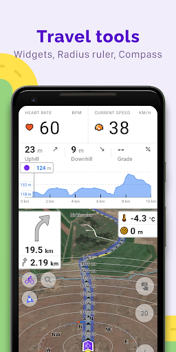
OsmAnd — Maps & GPS Offline is an offline world map application that offers navigation based on OpenStreetMap data. It allows users to plan routes, record GPX tracks, and navigate without an internet connection, supporting various vehicles and activities. The app features customizable map styles, navigation profiles, and the ability to manage GPX tracks all under an open-source framework. Users benefit from real-time updates, community support, and additional paid features for enhanced functionality.
App stats
Permissions:
- android.permission.ACCESS_COARSE_LOCATION
- android.permission.ACCESS_FINE_LOCATION
- android.permission.ACCESS_LOCATION_EXTRA_COMMANDS
- android.permission.ACCESS_NETWORK_STATE
- android.permission.ACCESS_WIFI_STATE
- android.permission.BLUETOOTH_CONNECT
- android.permission.BLUETOOTH_SCAN
- android.permission.CAMERA
- android.permission.FOREGROUND_SERVICE
- android.permission.FOREGROUND_SERVICE_DATA_SYNC See more
Size: 207.74M
Email: su*****@osmand.net
URLs: Website ,Privacy policy
Full description: See detailed description
Ranking
Other platforms
Not available on Chrome
Not available on Firefox
Not available on Edge
User reviews
Pros
- Great offline maps for the whole world
- Customizable with many features for various terrains
- No ads and information overload
- Open source and community-updated
- Effective for off-grid navigation, cycling, and trail running
Cons
- Unintuitive user interface and confusing configuration
- Limited address lookup functionality
- Subscription cost perceived as high
- GPS routing algorithm can be unreliable
- Frequent charging for map downloads and limitations on downloads
Most mentioned
- UI complexity and learning curve
- Address search functionality issues
- High subscription costs and download limits
- Routing accuracy and algorithm problems
- Great offline capabilities and detailed maps
User reviews
I've had it for years. Great maps for the whole world. Works offline. Many, many features. A lot of information about the terrain. Routing. A few different distinctive map types to choose from general purpose maps to topographical maps ( good for driving, hiking, MTB, city tours etc.) many overlays. All trails are on these maps. Customise it to own needs. Every terrain detail is on these maps. You always know where to go.
by  Voy P, 2025-01-26
OSMAnd is my go-to for exploring my area. It provides unique details like pedestrian warnings and stop signs that other maps miss. GPX tracks are easy to record. However, the UI is unintuitive. The "Configure Map" button and sidebar are confusing, with overlapping functions. GPX tracks should be easier to access, and adding stops requires effort. In "Maps and Resources," live updates and downloads should come first. Still, OSMAnd is functional and fun, especially seeing my edits live.
by  Richard, 2025-01-12