Maps Measure
Measure the world! Calculate distances, areas and elevations in Google Maps

Maps Measure: Measure Distances & Areas in Google Maps
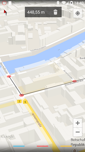
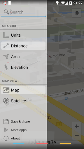
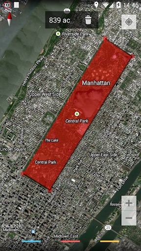
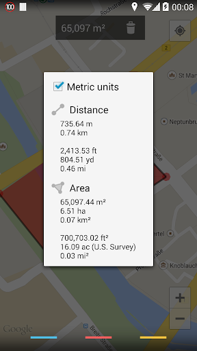
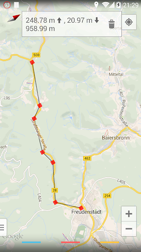
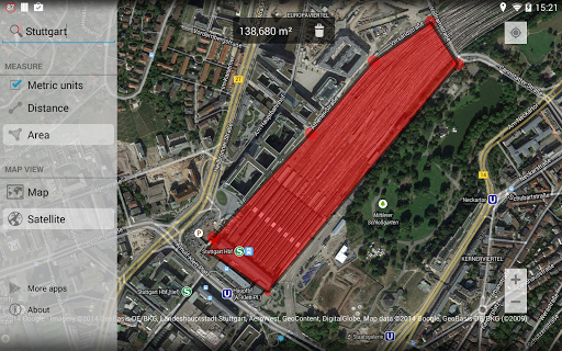
"Maps Measure" is a simple Android app for measuring distances and areas using Google Maps. Users can add points on the map to calculate distance, area, or elevation, with minimal permissions and no ads. It supports multiple unit systems and includes various map views. Elevation measurements are available via in-app purchase, and the app is open source and available on GitHub.
App stats
By: j4velin
Rating: 4.35 
3 new ratings
(8,678)
Permissions:
- android.permission.ACCESS_COARSE_LOCATION
- android.permission.ACCESS_FINE_LOCATION
- android.permission.ACCESS_NETWORK_STATE
- android.permission.INTERNET
- com.android.vending.BILLING
- com.google.android.providers.gsf.permission.READ_GSERVICES
Size: 620.47K
Email: j4*****@gmail.com
URLs: Website ,Privacy policy
Full description: See detailed description
Other platforms
Not available on Chrome
Not available on Firefox
Not available on Edge
User reviews
Pros
- Accurate distance measurements
- Useful for planning walks and runs
- Good elevation measurement feature
- Simple and straightforward interface
Cons
- Recent updates have introduced bugs
- Elevation API often does not work
- Issues with screen size on certain devices
- Incompatibility with newer Android versions
Most mentioned
- Elevation feature issues
- Bugs in the newer version of the app
- User desire for more measurement unit options
- Screen display problems on certain devices
User reviews
This seems to work well as a replacement for Planimeter - GPS Area Measure since they auto-updated to a subscription model and killed everyone's purchased app.
by  Jason B, 2024-08-09
Dear team, Pls add more function like distance also mentioned with lat,long parellely. Thanks
by  SONU TIWARI, 2024-07-30