Wasatch Backcountry Skiing Map
Wasatch Backcountry Map is the digital map for skiers and hikers in Utah.


Wasatch Backcountry Skiing Map - Utah Hiking & Skiing
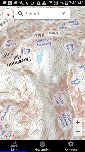
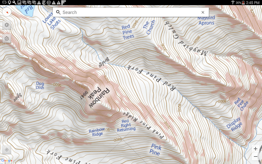
"Wasatch Backcountry Skiing Map" is an essential Android app for skiers and hikers in Utah, offering a detailed map of over 1,000 backcountry spots in the Central Wasatch mountains. The app features GPS tracking, elevation data, avalanche terrain shading, and links to detailed location information. It's perfect for outdoor enthusiasts as it works without cell service, ensuring that you can navigate the backcountry confidently. Contact support for assistance before leaving a review.
App stats
By: Iterum, LLC
Rating: 3.95 
(46)
Permissions:
- android.permission.ACCESS_COARSE_LOCATION
- android.permission.ACCESS_FINE_LOCATION
- android.permission.ACCESS_NETWORK_STATE
- android.permission.INTERNET
- com.iterum.wbsa.DYNAMIC_RECEIVER_NOT_EXPORTED_PERMISSION
Size: 81.21M
Price: 12.99
Email: in*****@iterum.com
URLs: Website ,Privacy policy
Full description: See detailed description
Other platforms
Not available on Chrome
Not available on Firefox
Not available on Edge
User reviews
The map is not very high resolution, and the app is just that, a topo map. Happy to support UAC, but this app is not useful, would love to see routes/info about areas or something more than just a map. Recommend Trailforks or OnX for app functions and viewing GPS location/topo info, will be purchasing a physical topo map in place of this.
by  Spencer Reynolds, 2025-01-15
Not worth it. There's little information on slope angle and not much information you can't get elsewhere. Save your money for a CalTopo subscription and you'll be much happier.
by  Nick Bourdon, 2023-11-23